
Kiribati
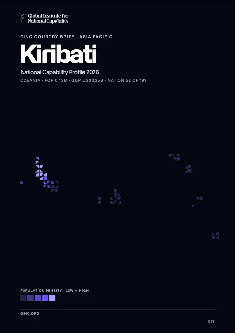
Kiribati is a republic in Oceania, home to 104,000 people, with its capital at Tarawa.
Contents
12 chapters
Foundations
01–03
At a glance
- Area
- 811km²#185 World#9 Oceania
- Population
- 104.5K#193 World#12 Oceania
- GDP (market)
- $173M
- GDP (PPP)
- $698M#212 World#13 Oceania
- GDP per capita
- $6.4K#147 World#13 Oceania
The whole brief
Kiribati National Capability Profile 2026
Foundations · Chapter 01
Historical Context
🇰🇮 Kiribati’s understanding the origins and evolution of the modern nation
BackgroundBack to top ↑
The Gilbert Islands became a British protectorate in 1892 and a colony in 1915; they were captured by the Japanese in the Pacific War in 1941. The islands of Makin and Tarawa were the sites of major US amphibious victories over entrenched Japanese garrisons in 1943. The Gilbert Islands were granted self-rule by the UK in 1971 and complete independence in 1979 under the new name of Kiribati. The US relinquished all claims to the sparsely inhabited Phoenix and Line Island groups in a 1979 treaty of friendship with Kiribati.
IndependenceBack to top ↑
12 July 1979 (from the UK)
National holidayBack to top ↑
Independence Day, 12 July (1979)
Foundations · Chapter 02
Geography
🇰🇮 Kiribati’s territory, resources and strategic position
Location and areaBack to top ↑
Oceania, group of 33 coral atolls in the Pacific Ocean, straddling the Equator; the capital Tarawa is about half way between Hawaii and Australia
1 25 N, 173 00 E
Oceania
four times the size of Washington, DC
0 km
1,143 km
Terrain and resourcesBack to top ↑
mostly low-lying coral atolls surrounded by extensive reefs
phosphate (production discontinued in 1979)
NA
Settlement and hazardsBack to top ↑
typhoons can occur any time, but usually November to March; occasional tornadoes; low level of some of the islands make them sensitive to changes in sea level
21 of the 33 islands are inhabited; Banaba (Ocean Island) in Kiribati is one of the three great phosphate rock islands in the Pacific Ocean - the others are Makatea in French Polynesia, and Nauru; Kiribati is the only country in the world to fall into all four hemispheres (northern, southern, eastern, and western)
OtherBack to top ↑
heavy pollution in lagoon of south Tarawa atoll due to heavy migration mixed with traditional practices such as lagoon latrines and open-pit dumping; ground water at risk
Foundations · Chapter 03
Environment
🇰🇮 Kiribati’s environmental conditions, resources and national resilience
ClimateBack to top ↑
tropical; marine, hot and humid, moderated by trade winds
Emissions and pollutionBack to top ↑
Resources and agreementsBack to top ↑
GINC Capability Domains · Chapter 04
Critical Technology
🇰🇮 Kiribati’s technology frontiers and the pursuit of national advantage
Two counts are set side by side for 2015–2024: on the left, the papers researchers in Kiribati published; on the right, the patent families that began there and were filed in more than one country. First by capability group, then group by group with each group’s capabilities. The badge on a card is the nation’s place among all nations. Papers are from GINC Research Analytics, patent families from GINC Patents.
Research by capability group
#218 WorldPapers published, 2015–2024
Patents by capability group
International patent families, 2015–2024
No international patent families on record for 2015–2024.
Advanced Materials & ManufacturingBack to top ↑
- Structural & Composite Materials
- Functional Materials & Coatings
- Nanomaterials & Metamaterials
- Superconducting, Magnetic & Photonic Materials
- Energetic Materials
- Additive & Precision Manufacturing
- Advanced Chemical & Process Manufacturing
Energy TechnologiesBack to top ↑
- Batteries & Energy Storage
- Hydrogen, Ammonia & Sustainable Fuels
- Next-Generation Solar & Renewables
- Advanced Nuclear & Fusion
- Directed Energy Technologies
Semiconductors & Advanced ComputingBack to top ↑
- Semiconductor Design & EDA
- Advanced Semiconductor Fabrication
- Semiconductor Equipment & Materials
- Advanced Packaging & Heterogeneous Integration
- Compound & Power Semiconductors
- High-Performance & AI Computing
Artificial IntelligenceBack to top ↑
Research
#194 WorldPapers published, 2015–2024
Patents
International patent families, 2015–2024
No international patent families on record for 2015–2024.
Quantum TechnologiesBack to top ↑
Connectivity, Cyber & Trust TechnologiesBack to top ↑
- Advanced Optical Communication & Photonics
- Advanced Wireless Communication
- Resilient & Infrastructure-Independent Networks
- Protective Cybersecurity Technologies
- Privacy, Identity & Trust Technologies
Sensing, Timing & NavigationBack to top ↑
- Precision Timing & Atomic Clocks
- Resilient Positioning & Navigation
- Advanced Imaging & Photonic Sensing
- Radar & Radiofrequency Sensing
- Acoustic & Undersea Sensing
Robotics & Autonomous SystemsBack to top ↑
- Advanced Robotics
- Autonomous Systems & Trusted Autonomy
- Uncrewed & Collaborative Systems
- Human-Machine Interfaces
Biotechnology & Health TechnologiesBack to top ↑
- Genomics & Biological Data
- Synthetic Biology & Genetic Engineering
- Biomanufacturing
- Nuclear Medicine & Radioisotope Technologies
- Advanced Therapeutics, Vaccines & Medical Countermeasures
Space TechnologiesBack to top ↑
- Space Launch & Reusable Systems
- Advanced Propulsion & Hypersonic Systems
- Satellite & Constellation Technologies
GINC Capability Domains · Chapter 05
Strategic Infrastructure
🇰🇮 Kiribati’s energy, connectivity and the material foundations of capability
Resource InfrastructureBack to top ↑
0 bbl/day (2012 est.)
0 bbl/day (2010 est.)
0 bbl/day (2010 est.)
0 bbl (1 January 2013 est.)
0 bbl/day (2010 est.)
300 bbl/day (2011 est.)
0 bbl/day (2010 est.)
420 bbl/day (2010 est.)
0 cu m (2011 est.)
0 cu m (2010 est.)
0 cu m (2011 est.)
0 cu m (2011 est.)
0 cu m (1 January 2013 est.)
Agriculture & Food InfrastructureBack to top ↑
- Irrigation & Agricultural Water
- Livestock & Veterinary
- Fisheries & Aquaculture
- Storage, Cold Chain & Markets
Energy InfrastructureBack to top ↑
- Thermal Generation
- Nuclear Generation
- Nuclear Fuel Cycle & Radioactive Waste
- Hydropower
- Renewable Generation
- Transmission & Distribution
- System Control & Dispatch
- Storage & Fuel Supply
5,000 kW (2010 est.)
25 million kWh (2010 est.)
23.25 million kWh (2010 est.)
0 kWh (2012 est.)
0 kWh (2012 est.)
100% of total installed capacity (2010 est.)
0% of total installed capacity (2010 est.)
0% of total installed capacity (2010 est.)
0% of total installed capacity (2010 est.)
59,340 Mt (2011 est.)
Water, Sanitation & Waste InfrastructureBack to top ↑
- Dams, Reservoirs & Flood Defence
- Water Supply & Treatment
- Bulk Water Transfer & Desalination
- Wastewater & Sanitation
- Solid Waste & Recycling
Advanced ManufacturingBack to top ↑
- Materials & Inputs
- Chemicals & Hazardous Process Industry
- Production Systems
- Supply Chain & Ecosystem
- Workforce & Innovation
Transport InfrastructureBack to top ↑
- Seaports & Terminals
- Air Infrastructure
- Air Navigation & Traffic Management
- Inland Waterways & Ferries
- Rail Infrastructure
- Roads & Bridges
- Logistics, Multimodal & Border Infrastructure
- Postal & Parcel
19 (2013)
5 km (small network of canals in Line Islands) (2012)
Communications & Digital InfrastructureBack to top ↑
- Subsea Cables & International Gateways
- Core & Backbone Networks
- Mobile & Wireless Networks
- Spectrum & Broadcasting
- Data Centres, Compute & Cloud
- Data Resources
- AI Tools & Applications
9,000 (2012)
16,000 (2012)
7,800 (2009)
327 (2012)
.ki
Financial InfrastructureBack to top ↑
- Currency & Reserves
- Payments & Settlement Systems
- Markets, Exchanges & Depositories
- Banks, Insurers & Systemic Institutions
Social InfrastructureBack to top ↑
- Health Infrastructure
- Public Health & Laboratories
- Medical Supply & Stockpiles
- Education & Skills Infrastructure
- Research & Scientific Facilities
- Housing, Community & Social Services
- Government & Public Administration
- Cultural, Community & Recreational Infrastructure
- Justice & Corrections
- Emergency Services & Civil Protection
- Hydrometeorology & Early Warning
Space, Aerospace & Defence InfrastructureBack to top ↑
GINC Capability Domains · Chapter 06
National Security
🇰🇮 Kiribati’s force, intelligence and the defence of the nation
Disputes and terrorismBack to top ↑
none
Force Generation & MobilisationBack to top ↑
no regular military forces (establishment prevented by the constitution); Police Force (2011)
Kiribati does not have military forces; defense assistance is provided by Australia and NZ
Forces under arms
Active-duty strength on the Correlates of War series, which reaches back to 1816 and so carries a nation’s whole record of mobilisation rather than its present establishment. The card opens the full cross-country comparison.
Intelligence & AssessmentBack to top ↑
- Imagery & Geospatial Intelligence
- Signals & Cyber Intelligence
- Technical & Measurement Intelligence
- Open-Source & Financial Intelligence
- Human Intelligence & Counterintelligence
- All-Source Analysis & Warning
Joint Command, Projection & SustainmentBack to top ↑
- Command, Control & Communications
- Strategic Lift & Mobility
- Expeditionary & Peace Operations
- Operational Sustainment & War Reserves
- Defence Industrial Mobilisation
- CBRN Defence
Land PowerBack to top ↑
- Combined Arms Manoeuvre
- Land Fires
- Battlefield Aviation & Uncrewed Systems
- Special Operations & Irregular Warfare
Maritime PowerBack to top ↑
- Maritime Security & Constabulary
- Sea Denial & Undersea Warfare
- Sea Control
- Amphibious & Expeditionary Operations
Air PowerBack to top ↑
- Air Sovereignty & Policing
- Control of the Air
- Air Strike & Interdiction
- Airborne ISR, Early Warning & Battle Management
Strategic Strike & Missile DefenceBack to top ↑
Space OperationsBack to top ↑
Cyber & Electromagnetic OperationsBack to top ↑
Nuclear DeterrenceBack to top ↑
GINC Capability Domains · Chapter 07
Human Capital
🇰🇮 Kiribati’s population, health and the skills that sustain capability
DemographyBack to top ↑
104,488 (July 2014 est.)
1.18% (2014 est.)
21.85 births/1,000 population (2014 est.)
7.18 deaths/1,000 population (2014 est.)
2.56 children born/woman (2014 est.)
23.1
22.3% (2009)
Migration and urbanisationBack to top ↑
-2.86 migrant(s)/1,000 population (2014 est.)
TARAWA (capital) 44,000 (2011)
Welfare and equityBack to top ↑
NA%
Early Childhood DevelopmentBack to top ↑
Foundational EducationBack to top ↑
NA
12% of GDP (2001)
Advanced EducationBack to top ↑
Technical & Vocational SkillsBack to top ↑
Digital & AI CompetenceBack to top ↑
Lifelong Learning & ReskillingBack to top ↑
Research Talent & Knowledge CreationBack to top ↑
Population HealthBack to top ↑
9 deaths/100,000 live births (2008)
46% (2008)
NA
NA
NA
Health System CapabilityBack to top ↑
10.1% of GDP (2011)
0.38 physicians/1,000 population (2010)
1.3 beds/1,000 population (2011)
GINC Capability Domains · Chapter 08
Governance and Integrity
🇰🇮 Kiribati’s institutions, law and the integrity of the state
State structureBack to top ↑
republic
3 geographical units: Gilbert Islands, Line Islands, Phoenix Islands; note - there are no first-order administrative divisions but there are 6 districts (Banaba, Central Gilberts, Line Islands, Northern Gilberts, Southern Gilberts, Tarawa) and 21 island councils - one for each of the inhabited islands (Abaiang, Abemama, Aranuka, Arorae, Banaba, Beru, Butaritari, Kanton, Kiritimati, Kuria, Maiana, Makin, Marakei, Nikunau, Nonouti, Onotoa, Tabiteuea, Tabuaeran, Tamana, Tarawa, Teraina)
preindependence - The Gilbert and Ellice Islands Order in Council 1915, The Gilbert Islands Order in Council 1975; latest promulgated 12 July 1979 (at independence); amended 1995 (2013)
18 years of age; universal
Political Institutions & Civic ParticipationBack to top ↑
- Electoral Management & Integrity
- Legislature & Deliberative Institutions
- Citizen Participation & Civic Space
unicameral House of Parliament or Maneaba Ni Maungatabu (46 seats; 44 members elected by popular vote, 1 ex officio member - the attorney general, 1 nominated by the Rabi Council of Leaders (representing Banaba Island); members serve four-year terms)
Boutokaan Te Koaua Party or BTK [Anote TONG]//Kamaeuraoan Te I-Kiribati Party or KTK [Tetaua TAITAI]//Maurin Kiribati Pati or MKP [Rimeta BENIAMINA]//
NA
Justice System & Fundamental RightsBack to top ↑
- Judicial Independence & Court Capability
- Access to Justice & Legal Services
- Fundamental Rights Protection
- Human Rights Institutions & Equality Bodies
English common law supplemented by customary law
has not submitted an ICJ jurisdiction declaration; non-party state to the ICCt
Internal Security & OrderBack to top ↑
Regulatory Governance & Strategic ControlsBack to top ↑
- Regulatory Quality & Better Regulation
- Regulatory Delivery & Independent Regulators
- Strategic Controls & Economic Security Administration
Government Effectiveness & Public AdministrationBack to top ↑
- Centre of Government & Policy Coordination
- Civil Service & Public Workforce
- Digital Government & Service Delivery
- Legal Identity & Civil Registration
- Statistical & Data Capability
Public Integrity & Anti-CorruptionBack to top ↑
Transparency, Oversight & AccountabilityBack to top ↑
- Right to Information & Open Government
- Independent Oversight & Supreme Audit
- Independent Media & Journalist Safety
National Resilience & Crisis ManagementBack to top ↑
GINC Capability Domains · Chapter 09
Information and Influence
🇰🇮 Kiribati’s identity, media and the projection of influence
Identity and cultureBack to top ↑
I-Kiribati, English (official)
Roman Catholic 55.8%, Kempsville Presbyterian Church 33.5%, Mormon 4.7%, Baha'i 2.3%, Seventh-Day Adventist 2%, other 1.5%, none 0.2%, unspecified 0.05% (2010 est.)
I-Kiribati 89.5%, I-Kiribati/mixed 9.7%, Tuvaluan 0.1%, other 0.8% (2010 est.)
frigatebird
the upper half is red with a yellow frigatebird flying over a yellow rising sun, and the lower half is blue with three horizontal wavy white stripes to represent the Pacific ocean; the white stripes represent the three island groups - the Gilbert, Line, and Phoenix Islands; the 17 rays of the sun represent the 16 Gilbert Islands and Banaba (formerly Ocean Island); the frigatebird symbolizes authority and freedom
Diplomatic Statecraft & Global NetworksBack to top ↑
- Diplomatic Network & Consular Reach
- Multilateral Leadership & Norm Setting
- Agenda-Setting & Convening
- Mediation & Crisis Diplomacy
ACP, ADB, AOSIS, C, FAO, IBRD, ICAO, ICRM, IDA, IFAD, IFC, IFRCS, ILO, IMF, IMO, IOC, ITU, ITUC (NGOs), OPCW, PIF, Sparteca, SPC, UN, UNCTAD, UNESCO, UPU, WHO, WMO
the US does not have an embassy in Kiribati; the US ambassador to Fiji, currently Ambassador Frankie A. REED, is accredited to Kiribati
Alliances & Security CooperationBack to top ↑
Development Cooperation & Global AssistanceBack to top ↑
Culture, Language & Education DiplomacyBack to top ↑
- Cultural & Language Institutes
- Creative Industries & Cultural Export Reach
- Heritage & Cultural Institutions
- Education Diplomacy & Alumni Networks
- Sports & Major Events
Diaspora & Global CommunitiesBack to top ↑
Information Environment & Strategic CommunicationBack to top ↑
- Strategic Communications & Public Diplomacy
- International Media & Broadcasting
- Information Defence & Counter-Interference
1 TV broadcast station that provides about 1 hour of local programming Monday-Friday; multi-channel TV packages provide access to Australian and US stations; 1 government-operated radio station broadcasts on AM, FM, and shortwave (2009)
GINC Capability Domains · Chapter 10
Financial Strength
🇰🇮 Kiribati’s fiscal depth, reserves and the capacity to act
Monetary & Currency CapabilityBack to top ↑
- Monetary Policy & Price Stability
- Exchange Rate & External Account Management
- Currency Issuance & Digital Money
0.2% (2007 est.)
Australian dollars (AUD) per US dollar -//1.031 (2011)//0.9695 (2011 est.)//1.2822 (2009)//1.2059 (2008)
Fiscal Capacity & Public FinanceBack to top ↑
- Revenue Mobilisation & Tax Administration
- Public Expenditure & Budget Management
- Sovereign Debt & Treasury Management
- Public Investment Management
32.1% of GDP (2010 est.)
-29.8% of GDP (2010 est.)
NA
Financial System Depth & AccessBack to top ↑
- Banking System Capacity
- Capital Markets Depth & Development
- Long-Term & Institutional Capital
- Financial Inclusion & Household Access
- Development & Policy Finance
$NA
Financial Regulation & IntegrityBack to top ↑
- Prudential Regulation & Supervision
- Financial Integrity & Illicit Finance Control
- Market Conduct & Consumer Protection
- Payment & Market Infrastructure Oversight
Financial Stability & Crisis ManagementBack to top ↑
- Macroprudential & Systemic Oversight
- Crisis Management, Resolution & Deposit Insurance
- External Liquidity & Financial Safety Nets
Sovereign Capital & External Financial PowerBack to top ↑
- Official Reserves Management
- Sovereign Wealth & Public Asset Management
- Currency Internationalisation & Reserve Status
- Capital Account & Flow Management
- International Financial Centre Capability
//$8.37 million (2010 est.)
$10 million (1999 est.)
GINC Capability Domains · Chapter 11
Production and Innovation
🇰🇮 Kiribati’s output, industry and the engine of prosperity
Economic Output & ProductivityBack to top ↑
A remote country of 33 scattered coral atolls, Kiribati has few natural resources and is one of the least developed Pacific Islands. Commercially viable phosphate deposits were exhausted at the time of independence from the UK in 1979. Copra and fish now represent the bulk of production and exports. The economy has fluctuated widely in recent years. Economic development is constrained by a shortage of skilled workers, weak infrastructure, and remoteness from international markets. Tourism provides more than one-fifth of GDP. Private sector initiatives and a financial sector are in the early stages of development. Foreign financial aid from the EU, UK, US, Japan, Australia, New Zealand, Canada, UN agencies, and Taiwan accounts for 20-25% of GDP. Remittances from seamen on merchant ships abroad account for more than $5 million each year. Kiribati receives around $15 million annually for the government budget from an Australian trust fund.
$698 million (2013 est.)//$678.2 million (2012 est.)//$660.1 million (2011 est.)
2.9% (2013 est.)//2.8% (2012 est.)//2.7% (2011 est.)
$6,400 (2013 est.)//$6,300 (2012 est.)//$6,300 (2011 est.)
$173 million (2013 est.)
Labour & EmploymentBack to top ↑
- Employment & Labour Force Participation
- Labour Market Institutions & Wage Setting
- Employment Services & Skills Matching
- Labour Adjustment, Transition & Formalisation
7,870
2% (1992 est.)
Industrial & Sectoral BaseBack to top ↑
- Manufacturing & Advanced Industry
- Foundational & Process Industries
- Agrifood & Primary Production
- Services Economy
copra, taro, breadfruit, sweet potatoes, vegetables; fish
fishing, handicrafts
NA%
Structural Transformation & ComplexityBack to top ↑
Business Dynamism & EntrepreneurshipBack to top ↑
- Entrepreneurship & Firm Creation
- Risk Capital & Scale-Up Finance
- Firm Growth, Exit & Renewal
- Competition & Market Contestability
Innovation & CommercialisationBack to top ↑
- Business Innovation Capability
- Research Commercialisation & Knowledge Transfer
- Intellectual Property & Intangible Assets
- Innovation Ecosystems & Clusters
Technology Adoption & DiffusionBack to top ↑
GINC Capability Domains · Chapter 12
Trade and Investment
🇰🇮 Kiribati’s markets, capital and the terms of global exchange
Overall tradeBack to top ↑
$109M of exports to 49 partners and $187M of imports from 43 in 2024, a deficit of $77.5M.
- Exports
- $109M49 partners
- Imports
- $187M43 partners
- Balance
- −$77.5Mdeficit
- Total trade
- $296M2024
ExportsBack to top ↑
Where its exports go
The largest partners in 2024, with each one's share of the nation's exports.
| Partner | Value | Share | |
|---|---|---|---|
| Thailand | $68.9M | 63% | |
| Colombia | $13.9M | 13% | |
| Indonesia | $7.70M | 7.0% | |
| Japan | $4.93M | 4.5% | |
| Philippines | $3.18M | 2.9% | |
| South Korea | $2.51M | 2.3% | |
| Spain | $2.06M | 1.9% | |
| Italy | $1.67M | 1.5% | |
| Fiji | $1.01M | 0.9% | |
| France | $896K | 0.8% | |
| United States | $892K | 0.8% | |
| United Kingdom | $516K | 0.5% | |
| Hong Kong | $414K | 0.4% | |
| Malaysia | $256K | 0.2% | |
| Ecuador | $96.8K | <0.1% | |
| Sri Lanka | $77.7K | <0.1% | |
| Canada | $72.3K | <0.1% | |
| Bulgaria | $65.9K | <0.1% | |
| New Zealand | $52.5K | <0.1% | |
| Pakistan | $33.5K | <0.1% |
What it exports
The largest categories in 2024.
| Category | Value | Share | |
|---|---|---|---|
| Fish, crustaceans, molluscs, aquatics invertebrates | $98.5M | 90% | |
| Ships, boats, and other floating structures | $7.70M | 7.0% | |
| Animal, vegetable fats and oils, cleavage products | $758K | 0.7% | |
| Oil seed, oleaginous fruits, grain, seed, fruits | $396K | 0.4% | |
| Electrical, electronic equipment | $370K | 0.3% | |
| Meat, fish and seafood preparations | $332K | 0.3% | |
| Miscellaneous articles of base metal | $174K | 0.2% | |
| Other made textile articles, sets, worn clothing | $170K | 0.2% | |
| Machinery, nuclear reactors, boilers | $158K | 0.1% | |
| Iron and steel | $145K | 0.1% | |
| Aluminum | $125K | 0.1% | |
| Products of animal origin | $96.8K | <0.1% | |
| Articles of apparel, not knit or crocheted | $84.8K | <0.1% | |
| Miscellaneous chemical products | $66.1K | <0.1% | |
| Milling products, malt, starches, inulin, wheat gluten | $44.1K | <0.1% |
ImportsBack to top ↑
Where its imports come from
The largest partners in 2024, with each one's share of the nation's imports.
| Partner | Value | Share | |
|---|---|---|---|
| China | $53.8M | 29% | |
| Fiji | $26.9M | 14% | |
| Japan | $22.0M | 12% | |
| Australia | $21.2M | 11% | |
| New Zealand | $13.2M | 7.1% | |
| Taiwan | $10.6M | 5.7% | |
| South Korea | $8.37M | 4.5% | |
| Thailand | $6.64M | 3.6% | |
| Indonesia | $4.32M | 2.3% | |
| Singapore | $3.63M | 1.9% | |
| India | $3.27M | 1.7% | |
| Denmark | $2.97M | 1.6% | |
| Malaysia | $2.86M | 1.5% | |
| United States | $2.83M | 1.5% | |
| Hong Kong | $1.03M | 0.6% | |
| Philippines | $1.00M | 0.5% | |
| Italy | $410K | 0.2% | |
| Poland | $368K | 0.2% | |
| Brazil | $257K | 0.1% | |
| Finland | $175K | <0.1% |
What it imports
The largest categories in 2024.
| Category | Value | Share | |
|---|---|---|---|
| Machinery, nuclear reactors, boilers | $19.9M | 11% | |
| Ships, boats, and other floating structures | $19.4M | 10% | |
| Vehicles other than railway, tramway | $14.9M | 8.0% | |
| Electrical, electronic equipment | $11.0M | 5.9% | |
| Cereal, flour, starch, milk preparations and products | $8.61M | 4.6% | |
| Mineral fuels, oils, distillation products | $8.26M | 4.4% | |
| Meat, fish and seafood preparations | $8.16M | 4.4% | |
| Articles of iron or steel | $7.98M | 4.3% | |
| Plastics | $7.64M | 4.1% | |
| Sugars and sugar confectionery | $5.98M | 3.2% | |
| Meat and edible meat offal | $5.28M | 2.8% | |
| Cereals | $4.89M | 2.6% | |
| Furniture, lighting signs, prefabricated buildings | $4.73M | 2.5% | |
| Wadding, felt, nonwovens, yarns, twine, cordage | $4.62M | 2.5% | |
| Beverages, spirits and vinegar | $4.34M | 2.3% |
In a list, the bar runs to the largest in that list. The line is each figure’s history from 2000, drawn to its own peak: it shows the shape of the years, and the value shows the size.
External balanceBack to top ↑
-$35.01 million (2010 est.)//-$21 million (2007 est.)
Trade Facilitation & LogisticsBack to top ↑
Trade Policy & Market AccessBack to top ↑
- Trade Policy & Negotiation Capability
- Market Access & Agreements Network
- Trade Law & Enforcement
- Standards, Conformity & Quality Infrastructure
Digital & Services TradeBack to top ↑
- Services Trade Capability
- Digital Trade & E-Commerce
- Data Flows & Digital Trade Governance
- Tourism & Visitor Economy
Investment Attraction & ProjectionBack to top ↑
- Investment Attraction & Facilitation
- Investment Absorption & Linkages
- Outward Investment & Global Corporate Presence
Export Capability & SophisticationBack to top ↑
$7.066 million (2010 est.)//$17 million (2004 est.)
copra 62%, coconuts, seaweed, fish
Global Value Chain PositionBack to top ↑
- Value Chain Participation & Integration
- Value Chain Position & Upgrading
- Regional Integration & Hub Anchoring
Economic Leverage & DependenceBack to top ↑
- Strategic Supply Security
- Concentration Risk & Revenue Stabilisation
- Economic Leverage & Coercion Resistance
$80.09 million (2010 est.)//$62 million (2004 est.)
foodstuffs, machinery and equipment, miscellaneous manufactured goods, fuel
Kiribati · you are in
Historical Context
Foundations
GINC Capability Domains
Find in this brief · Kiribati