
Marshall Islands
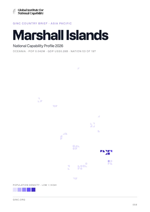
Marshall Islands is a constitutional government in free association with the US state in Oceania, home to 71,000 people, with its capital at Majuro.
Contents
12 chapters
Foundations
01–03
At a glance
- Area
- 181km²#213 World#18 Oceania
- Population
- 71K#202 World#13 Oceania
- GDP (market)
- $193M
- GDP (PPP)
- $486M#217 World#15 Oceania
- GDP per capita
- $8.7K#129 World#9 Oceania
The whole brief
Marshall Islands National Capability Profile 2026
Foundations · Chapter 01
Historical Context
🇲🇭 the Marshall Islands’ understanding the origins and evolution of the modern nation
BackgroundBack to top ↑
After almost four decades under US administration as the easternmost part of the UN Trust Territory of the Pacific Islands, the Marshall Islands attained independence in 1986 under a Compact of Free Association. Compensation claims continue as a result of US nuclear testing on some of the atolls between 1947 and 1962. The Marshall Islands hosts the US Army Kwajalein Atoll (USAKA) Reagan Missile Test Site, a key installation in the US missile defense network.
IndependenceBack to top ↑
21 October 1986 (from the US-administered UN trusteeship)
National holidayBack to top ↑
Constitution Day, 1 May (1979)
Foundations · Chapter 02
Geography
🇲🇭 the Marshall Islands’ territory, resources and strategic position
Location and areaBack to top ↑
Oceania, two archipelagic island chains of 29 atolls, each made up of many small islets, and five single islands in the North Pacific Ocean, about half way between Hawaii and Australia
9 00 N, 168 00 E
Oceania
about the size of Washington, DC
0 km
370.4 km
Terrain and resourcesBack to top ↑
low coral limestone and sand islands
coconut products, marine products, deep seabed minerals
0 sq km (2011)
Settlement and hazardsBack to top ↑
infrequent typhoons
the islands of Bikini and Enewetak are former US nuclear test sites; Kwajalein atoll, famous as a World War II battleground, surrounds the world's largest lagoon and is used as a US missile test range; the island city of Ebeye is the second largest settlement in the Marshall Islands, after the capital of Majuro, and one of the most densely populated locations in the Pacific
OtherBack to top ↑
inadequate supplies of potable water; pollution of Majuro lagoon from household waste and discharges from fishing vessels
Foundations · Chapter 03
Environment
🇲🇭 the Marshall Islands’ environmental conditions, resources and national resilience
ClimateBack to top ↑
tropical; hot and humid; wet season May to November; islands border typhoon belt
Emissions and pollutionBack to top ↑
Resources and agreementsBack to top ↑
GINC Capability Domains · Chapter 04
Critical Technology
🇲🇭 the Marshall Islands’ technology frontiers and the pursuit of national advantage
Two counts are set side by side for 2015–2024: on the left, the papers researchers in the Marshall Islands published; on the right, the patent families that began there and were filed in more than one country. First by capability group, then group by group with each group’s capabilities. The badge on a card is the nation’s place among all nations. Papers are from GINC Research Analytics, patent families from GINC Patents.
Research by capability group
Papers published, 2015–2024
No papers on record for 2015–2024.
Patents by capability group
#124 WorldInternational patent families, 2015–2024
Advanced Materials & ManufacturingBack to top ↑
- Structural & Composite Materials
- Functional Materials & Coatings
- Nanomaterials & Metamaterials
- Superconducting, Magnetic & Photonic Materials
- Energetic Materials
- Additive & Precision Manufacturing
- Advanced Chemical & Process Manufacturing
Energy TechnologiesBack to top ↑
- Batteries & Energy Storage
- Hydrogen, Ammonia & Sustainable Fuels
- Next-Generation Solar & Renewables
- Advanced Nuclear & Fusion
- Directed Energy Technologies
Semiconductors & Advanced ComputingBack to top ↑
Research
Papers published, 2015–2024
No papers on record for 2015–2024.
No research topic: Semiconductor Design & EDA · Advanced Semiconductor Fabrication · Semiconductor Equipment & Materials · Advanced Packaging & Heterogeneous Integration
Patents
#69 WorldInternational patent families, 2015–2024
Artificial IntelligenceBack to top ↑
Quantum TechnologiesBack to top ↑
Connectivity, Cyber & Trust TechnologiesBack to top ↑
- Advanced Optical Communication & Photonics
- Advanced Wireless Communication
- Resilient & Infrastructure-Independent Networks
- Protective Cybersecurity Technologies
- Privacy, Identity & Trust Technologies
Sensing, Timing & NavigationBack to top ↑
- Precision Timing & Atomic Clocks
- Resilient Positioning & Navigation
- Advanced Imaging & Photonic Sensing
- Radar & Radiofrequency Sensing
- Acoustic & Undersea Sensing
Robotics & Autonomous SystemsBack to top ↑
- Advanced Robotics
- Autonomous Systems & Trusted Autonomy
- Uncrewed & Collaborative Systems
- Human-Machine Interfaces
Biotechnology & Health TechnologiesBack to top ↑
- Genomics & Biological Data
- Synthetic Biology & Genetic Engineering
- Biomanufacturing
- Nuclear Medicine & Radioisotope Technologies
- Advanced Therapeutics, Vaccines & Medical Countermeasures
Space TechnologiesBack to top ↑
- Space Launch & Reusable Systems
- Advanced Propulsion & Hypersonic Systems
- Satellite & Constellation Technologies
GINC Capability Domains · Chapter 05
Strategic Infrastructure
🇲🇭 the Marshall Islands’ energy, connectivity and the material foundations of capability
Resource InfrastructureBack to top ↑
Agriculture & Food InfrastructureBack to top ↑
- Irrigation & Agricultural Water
- Livestock & Veterinary
- Fisheries & Aquaculture
- Storage, Cold Chain & Markets
Energy InfrastructureBack to top ↑
- Thermal Generation
- Nuclear Generation
- Nuclear Fuel Cycle & Radioactive Waste
- Hydropower
- Renewable Generation
- Transmission & Distribution
- System Control & Dispatch
- Storage & Fuel Supply
Water, Sanitation & Waste InfrastructureBack to top ↑
- Dams, Reservoirs & Flood Defence
- Water Supply & Treatment
- Bulk Water Transfer & Desalination
- Wastewater & Sanitation
- Solid Waste & Recycling
Advanced ManufacturingBack to top ↑
- Materials & Inputs
- Chemicals & Hazardous Process Industry
- Production Systems
- Supply Chain & Ecosystem
- Workforce & Innovation
Transport InfrastructureBack to top ↑
- Seaports & Terminals
- Air Infrastructure
- Air Navigation & Traffic Management
- Inland Waterways & Ferries
- Rail Infrastructure
- Roads & Bridges
- Logistics, Multimodal & Border Infrastructure
- Postal & Parcel
15 (2013)
Communications & Digital InfrastructureBack to top ↑
- Subsea Cables & International Gateways
- Core & Backbone Networks
- Mobile & Wireless Networks
- Spectrum & Broadcasting
- Data Centres, Compute & Cloud
- Data Resources
- AI Tools & Applications
4,400 (2010)
3,800 (2010)
2,200 (2009)
3 (2012)
.mh
Financial InfrastructureBack to top ↑
- Currency & Reserves
- Payments & Settlement Systems
- Markets, Exchanges & Depositories
- Banks, Insurers & Systemic Institutions
Social InfrastructureBack to top ↑
- Health Infrastructure
- Public Health & Laboratories
- Medical Supply & Stockpiles
- Education & Skills Infrastructure
- Research & Scientific Facilities
- Housing, Community & Social Services
- Government & Public Administration
- Cultural, Community & Recreational Infrastructure
- Justice & Corrections
- Emergency Services & Civil Protection
- Hydrometeorology & Early Warning
Space, Aerospace & Defence InfrastructureBack to top ↑
GINC Capability Domains · Chapter 06
National Security
🇲🇭 the Marshall Islands’ force, intelligence and the defence of the nation
Disputes and terrorismBack to top ↑
claims US territory of Wake Island
Force Generation & MobilisationBack to top ↑
no regular military forces; Marshall Islands Police (2012)
defense is the responsibility of the US
Forces under arms
Active-duty strength on the Correlates of War series, which reaches back to 1816 and so carries a nation’s whole record of mobilisation rather than its present establishment. The card opens the full cross-country comparison.
Intelligence & AssessmentBack to top ↑
- Imagery & Geospatial Intelligence
- Signals & Cyber Intelligence
- Technical & Measurement Intelligence
- Open-Source & Financial Intelligence
- Human Intelligence & Counterintelligence
- All-Source Analysis & Warning
Joint Command, Projection & SustainmentBack to top ↑
- Command, Control & Communications
- Strategic Lift & Mobility
- Expeditionary & Peace Operations
- Operational Sustainment & War Reserves
- Defence Industrial Mobilisation
- CBRN Defence
Land PowerBack to top ↑
- Combined Arms Manoeuvre
- Land Fires
- Battlefield Aviation & Uncrewed Systems
- Special Operations & Irregular Warfare
Maritime PowerBack to top ↑
- Maritime Security & Constabulary
- Sea Denial & Undersea Warfare
- Sea Control
- Amphibious & Expeditionary Operations
Air PowerBack to top ↑
- Air Sovereignty & Policing
- Control of the Air
- Air Strike & Interdiction
- Airborne ISR, Early Warning & Battle Management
Strategic Strike & Missile DefenceBack to top ↑
Space OperationsBack to top ↑
Cyber & Electromagnetic OperationsBack to top ↑
Nuclear DeterrenceBack to top ↑
GINC Capability Domains · Chapter 07
Human Capital
🇲🇭 the Marshall Islands’ population, health and the skills that sustain capability
DemographyBack to top ↑
70,983 (July 2014 est.)
1.72% (2014 est.)
26.36 births/1,000 population (2014 est.)
4.24 deaths/1,000 population (2014 est.)
3.22 children born/woman (2014 est.)
20.7
44.6% (2007)
Migration and urbanisationBack to top ↑
-4.92 migrant(s)/1,000 population (2014 est.)
MAJURO (capital) 31,000 (2011)
Welfare and equityBack to top ↑
NA%
Early Childhood DevelopmentBack to top ↑
Foundational EducationBack to top ↑
12.2% of GDP (2003)
Advanced EducationBack to top ↑
Technical & Vocational SkillsBack to top ↑
Digital & AI CompetenceBack to top ↑
Lifelong Learning & ReskillingBack to top ↑
Research Talent & Knowledge CreationBack to top ↑
Population HealthBack to top ↑
45.4% (2008)
NA
NA
NA
Health System CapabilityBack to top ↑
16.5% of GDP (2011)
0.44 physicians/1,000 population (2010)
2.7 beds/1,000 population (2010)
GINC Capability Domains · Chapter 08
Governance and Integrity
🇲🇭 the Marshall Islands’ institutions, law and the integrity of the state
State structureBack to top ↑
constitutional government in free association with the US; the Compact of Free Association entered into force on 21 October 1986 and the Amended Compact entered into force in May 2004
24 municipalities; Ailinglaplap, Ailuk, Arno, Aur, Bikini & Kili, Ebon, Enewetak & Ujelang, Jabat, Jaluit, Kwajalein, Lae, Lib, Likiep, Majuro, Maloelap, Mejit, Mili, Namdrik, Namu, Rongelap, Ujae, Utrik, Wotho, Wotje
effective 1 May 1979; amended several times, last in 1990 (2005)
18 years of age; universal
Political Institutions & Civic ParticipationBack to top ↑
- Electoral Management & Integrity
- Legislature & Deliberative Institutions
- Citizen Participation & Civic Space
unicameral legislature or Nitijela (33 seats; members elected by popular vote to serve four-year terms)
traditionally there have been no formally organized political parties; what has existed more closely resembles factions or interest groups because they do not have party headquarters, formal platforms, or party structures; the following two "groupings" have competed in legislative balloting in recent years - Aelon Kein Ad Party [Michael KABUA] and United Democratic Party or UDP [Litokwa TOMEING]
NA
Justice System & Fundamental RightsBack to top ↑
- Judicial Independence & Court Capability
- Access to Justice & Legal Services
- Fundamental Rights Protection
- Human Rights Institutions & Equality Bodies
mixed legal system of US and English common law, customary law, and local statutes
accepts compulsory ICJ jurisdiction with reservations; accepts ICCt jurisdiction
Internal Security & OrderBack to top ↑
Regulatory Governance & Strategic ControlsBack to top ↑
- Regulatory Quality & Better Regulation
- Regulatory Delivery & Independent Regulators
- Strategic Controls & Economic Security Administration
Government Effectiveness & Public AdministrationBack to top ↑
- Centre of Government & Policy Coordination
- Civil Service & Public Workforce
- Digital Government & Service Delivery
- Legal Identity & Civil Registration
- Statistical & Data Capability
Public Integrity & Anti-CorruptionBack to top ↑
Transparency, Oversight & AccountabilityBack to top ↑
- Right to Information & Open Government
- Independent Oversight & Supreme Audit
- Independent Media & Journalist Safety
National Resilience & Crisis ManagementBack to top ↑
GINC Capability Domains · Chapter 09
Information and Influence
🇲🇭 the Marshall Islands’ identity, media and the projection of influence
Identity and cultureBack to top ↑
Marshallese (official) 98.2%, other languages 1.8% (1999 census)
Protestant 54.8%, Assembly of God 25.8%, Roman Catholic 8.4%, Bukot nan Jesus 2.8%, Mormon 2.1%, other Christian 3.6%, other 1%, none 1.5% (1999 census)
Marshallese 92.1%, mixed Marshallese 5.9%, other 2% (2006)
blue with two stripes radiating from the lower hoist-side corner - orange (top) and white; a white star with four large rays and 20 small rays appears on the hoist side above the two stripes; blue represents the Pacific Ocean, the orange stripe signifies the Ralik Chain or sunset and courage, while the white stripe signifies the Ratak Chain or sunrise and peace; the star symbolizes the cross of Christianity, each of the 24 rays designates one of the electoral districts in the country and the four larger rays highlight the principal cultural centers of Majuro, Jaluit, Wotje, and Ebeye; the rising diagonal band can also be interpreted as representing the equator, with the star showing the archipelago's position just to the north
Diplomatic Statecraft & Global NetworksBack to top ↑
- Diplomatic Network & Consular Reach
- Multilateral Leadership & Norm Setting
- Agenda-Setting & Convening
- Mediation & Crisis Diplomacy
ACP, ADB, AOSIS, FAO, G-77, IAEA, IBRD, ICAO, IDA, IFAD, IFC, ILO, IMF, IMO, IMSO, Interpol, IOC, ITU, OPCW, PIF, Sparteca, SPC, UN, UNCTAD, UNESCO, WHO
Alliances & Security CooperationBack to top ↑
Development Cooperation & Global AssistanceBack to top ↑
Culture, Language & Education DiplomacyBack to top ↑
- Cultural & Language Institutes
- Creative Industries & Cultural Export Reach
- Heritage & Cultural Institutions
- Education Diplomacy & Alumni Networks
- Sports & Major Events
Diaspora & Global CommunitiesBack to top ↑
Information Environment & Strategic CommunicationBack to top ↑
- Strategic Communications & Public Diplomacy
- International Media & Broadcasting
- Information Defence & Counter-Interference
no TV broadcast station; a cable network is available on Majuro with programming via videotape replay and satellite relays; 4 radio broadcast stations; American Armed Forces Radio and Television Service (AFRTS) provides satellite radio and television service to Kwajalein Atoll (2009)
GINC Capability Domains · Chapter 10
Financial Strength
🇲🇭 the Marshall Islands’ fiscal depth, reserves and the capacity to act
Monetary & Currency CapabilityBack to top ↑
- Monetary Policy & Price Stability
- Exchange Rate & External Account Management
- Currency Issuance & Digital Money
12.9% (2008 est.)//3% (2005 est.)
the US dollar is used
Fiscal Capacity & Public FinanceBack to top ↑
- Revenue Mobilisation & Tax Administration
- Public Expenditure & Budget Management
- Sovereign Debt & Treasury Management
- Public Investment Management
54.6% of GDP (FY09 est.)
0.4% of GDP (FY09 est.)
1 October - 30 September
Financial System Depth & AccessBack to top ↑
- Banking System Capacity
- Capital Markets Depth & Development
- Long-Term & Institutional Capital
- Financial Inclusion & Household Access
- Development & Policy Finance
Financial Regulation & IntegrityBack to top ↑
- Prudential Regulation & Supervision
- Financial Integrity & Illicit Finance Control
- Market Conduct & Consumer Protection
- Payment & Market Infrastructure Oversight
Financial Stability & Crisis ManagementBack to top ↑
- Macroprudential & Systemic Oversight
- Crisis Management, Resolution & Deposit Insurance
- External Liquidity & Financial Safety Nets
Sovereign Capital & External Financial PowerBack to top ↑
- Official Reserves Management
- Sovereign Wealth & Public Asset Management
- Currency Internationalisation & Reserve Status
- Capital Account & Flow Management
- International Financial Centre Capability
$87 million (2008 est.)//$86.5 million (FY99/00 est.)
GINC Capability Domains · Chapter 11
Production and Innovation
🇲🇭 the Marshall Islands’ output, industry and the engine of prosperity
Economic Output & ProductivityBack to top ↑
US assistance and lease payments for the use of Kwajalein Atoll as a US military base are the mainstay of this small island country. The Marshall Islands received roughly $1 billion in aid from the US during 1986-2001 under the original Compact of Free Association (Compact). In 2002 and 2003, the US and the Marshall Islands renegotiated the Compact's financial package for a 20-year period, from 2004 to 2024. Under the amended Compact, the Marshall Islands will receive roughly $1.5 billion in direct US assistance. Agricultural production, primarily subsistence, is concentrated on small farms; the most important commercial crops are coconuts and breadfruit. Industry is limited to handicrafts, tuna processing, and copra. Tourism holds some potential. The islands and atolls have few natural resources, and imports exceed exports. Under the amended Compact, the US is also funding, jointly with the Marshall Islands, a Trust Fund for the people of the Marshall Islands that will provide an income stream beyond 2024 when direct Compact aid is to end.
$486 million (2013 est.)//$475.4 million (2012 est.)//$467.2 million (2011 est.)
2.3% (2013 est.)//1.9% (2012 est.)//0.8% (2011 est.)
$8,700 (2013 est.)//$8,700 (2012 est.)//$8,800 (2011 est.)
$193 million (2013 est.)
Labour & EmploymentBack to top ↑
- Employment & Labour Force Participation
- Labour Market Institutions & Wage Setting
- Employment Services & Skills Matching
- Labour Adjustment, Transition & Formalisation
10,480 (2011 est.)
36% (2006 est.)//30.9% (2000 est.)
Industrial & Sectoral BaseBack to top ↑
- Manufacturing & Advanced Industry
- Foundational & Process Industries
- Agrifood & Primary Production
- Services Economy
coconuts, tomatoes, melons, taro, breadfruit, fruits; pigs, chickens
copra, tuna processing, tourism, craft items (from seashells, wood, and pearls)
NA%
Structural Transformation & ComplexityBack to top ↑
Business Dynamism & EntrepreneurshipBack to top ↑
- Entrepreneurship & Firm Creation
- Risk Capital & Scale-Up Finance
- Firm Growth, Exit & Renewal
- Competition & Market Contestability
Innovation & CommercialisationBack to top ↑
- Business Innovation Capability
- Research Commercialisation & Knowledge Transfer
- Intellectual Property & Intangible Assets
- Innovation Ecosystems & Clusters
Technology Adoption & DiffusionBack to top ↑
GINC Capability Domains · Chapter 12
Trade and Investment
🇲🇭 the Marshall Islands’ markets, capital and the terms of global exchange
Overall tradeBack to top ↑
$1.07B of exports to 77 partners and $12.8B of imports from 68 in 2024, a deficit of $11.7B.
- Exports
- $1.07B77 partners
- Imports
- $12.8B68 partners
- Balance
- −$11.7Bdeficit
- Total trade
- $13.8B2024
ExportsBack to top ↑
Where its exports go
The largest partners in 2024, with each one's share of the nation's exports.
| Partner | Value | Share | |
|---|---|---|---|
| Germany | $224M | 21% | |
| Denmark | $170M | 16% | |
| Thailand | $101M | 9.5% | |
| Cyprus | $74.5M | 7.0% | |
| Norway | $64.5M | 6.0% | |
| South Korea | $59.0M | 5.5% | |
| Indonesia | $50.5M | 4.7% | |
| Netherlands | $47.8M | 4.5% | |
| Pakistan | $47.1M | 4.4% | |
| Malta | $33.0M | 3.1% | |
| Tanzania | $31.0M | 2.9% | |
| Poland | $28.1M | 2.6% | |
| United States | $21.1M | 2.0% | |
| Greece | $20.1M | 1.9% | |
| Chile | $17.5M | 1.6% | |
| United Kingdom | $11.8M | 1.1% | |
| Italy | $11.7M | 1.1% | |
| Turkey | $11.6M | 1.1% | |
| Philippines | $7.77M | 0.7% | |
| China | $7.75M | 0.7% |
What it exports
The largest categories in 2024.
| Category | Value | Share | |
|---|---|---|---|
| Ships, boats, and other floating structures | $842M | 79% | |
| Mineral fuels, oils, distillation products | $106M | 9.9% | |
| Fish, crustaceans, molluscs, aquatics invertebrates | $97.6M | 9.1% | |
| Machinery, nuclear reactors, boilers | $8.55M | 0.8% | |
| Iron and steel | $2.47M | 0.2% | |
| Wood and articles of wood, wood charcoal | $2.41M | 0.2% | |
| Knitted or crocheted fabric | $1.20M | 0.1% | |
| Vehicles other than railway, tramway | $1.13M | 0.1% | |
| Animal, vegetable fats and oils, cleavage products | $884K | <0.1% | |
| Articles of iron or steel | $765K | <0.1% | |
| Electrical, electronic equipment | $590K | <0.1% | |
| Furniture, lighting signs, prefabricated buildings | $563K | <0.1% | |
| Aluminum | $513K | <0.1% | |
| Copper | $426K | <0.1% | |
| Footwear, gaiters and the like | $361K | <0.1% |
ImportsBack to top ↑
Where its imports come from
The largest partners in 2024, with each one's share of the nation's imports.
| Partner | Value | Share | |
|---|---|---|---|
| China | $5.31B | 42% | |
| South Korea | $2.59B | 20% | |
| Japan | $1.27B | 9.9% | |
| Netherlands | $684M | 5.4% | |
| Singapore | $397M | 3.1% | |
| Turkey | $377M | 2.9% | |
| Denmark | $361M | 2.8% | |
| Brazil | $320M | 2.5% | |
| Italy | $231M | 1.8% | |
| Germany | $213M | 1.7% | |
| Greece | $194M | 1.5% | |
| Taiwan | $134M | 1.1% | |
| Saudi Arabia | $115M | 0.9% | |
| Cyprus | $115M | 0.9% | |
| Indonesia | $106M | 0.8% | |
| Norway | $75.4M | 0.6% | |
| United States | $59.5M | 0.5% | |
| South Africa | $50.3M | 0.4% | |
| United Kingdom | $37.7M | 0.3% | |
| Poland | $29.7M | 0.2% |
What it imports
The largest categories in 2024.
| Category | Value | Share | |
|---|---|---|---|
| Ships, boats, and other floating structures | $9.29B | 73% | |
| Mineral fuels, oils, distillation products | $2.58B | 20% | |
| Machinery, nuclear reactors, boilers | $409M | 3.2% | |
| Articles of iron or steel | $143M | 1.1% | |
| Railway, tramway locomotives, rolling stock, equipment | $77.6M | 0.6% | |
| Electrical, electronic equipment | $53.6M | 0.4% | |
| Tanning, dyeing extracts, tannins, derivatives, pigments | $43.9M | 0.3% | |
| Optical, photo, technical, medical apparatus | $21.3M | 0.2% | |
| Plastics | $13.4M | 0.1% | |
| Wadding, felt, nonwovens, yarns, twine, cordage | $12.3M | <0.1% | |
| Meat and edible meat offal | $11.2M | <0.1% | |
| Vehicles other than railway, tramway | $10.7M | <0.1% | |
| Rubbers | $8.55M | <0.1% | |
| Beverages, spirits and vinegar | $6.68M | <0.1% | |
| Cereal, flour, starch, milk preparations and products | $6.61M | <0.1% |
In a list, the bar runs to the largest in that list. The line is each figure’s history from 2000, drawn to its own peak: it shows the shape of the years, and the value shows the size.
Trade Facilitation & LogisticsBack to top ↑
Trade Policy & Market AccessBack to top ↑
- Trade Policy & Negotiation Capability
- Market Access & Agreements Network
- Trade Law & Enforcement
- Standards, Conformity & Quality Infrastructure
Digital & Services TradeBack to top ↑
- Services Trade Capability
- Digital Trade & E-Commerce
- Data Flows & Digital Trade Governance
- Tourism & Visitor Economy
Investment Attraction & ProjectionBack to top ↑
- Investment Attraction & Facilitation
- Investment Absorption & Linkages
- Outward Investment & Global Corporate Presence
Export Capability & SophisticationBack to top ↑
$50.14 million (2011 est.)//$9.1 million (2000 est.)
copra cake, coconut oil, handicrafts, fish
Global Value Chain PositionBack to top ↑
- Value Chain Participation & Integration
- Value Chain Position & Upgrading
- Regional Integration & Hub Anchoring
Economic Leverage & DependenceBack to top ↑
- Strategic Supply Security
- Concentration Risk & Revenue Stabilisation
- Economic Leverage & Coercion Resistance
$118.7 million (2011 est.)//$54.7 million (2000 est.)
foodstuffs, machinery and equipment, fuels, beverages, tobacco
Marshall Islands · you are in
Historical Context
Foundations
GINC Capability Domains
Find in this brief · Marshall Islands